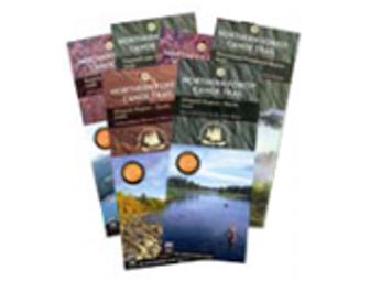
NFCT Map Set-Maine
Item Number: 258
Time Left: CLOSED
Description
As the Trail wends its way northeast through Maine’s western mountain region, toward the Allagash, and into the St. John River Valley, it traverses some truly stunning country. Mountains and ponds, rivers and streams, and a healthy dose of wildlife. Plan your trips on half of the Northern Forest Canoe Trail with these six first-edition sectional maps covering the NFCT in the state of Maine.
Map set includes:
Map 8: RANGELEY LAKES REGION MAINE Umbagog Lake to Rangeley Lake Map 9: FLAGSTAFF REGION MAINE Rangeley Lake to Spencer Stream Map 10: GREATER JACKMAN REGION MAINE Spencer Stream to Moosehead Lake Map 11: MOOSEHEAD/PENOBSCOT REGION MAINE Moosehead Lake to Umbazooksus Stream Map 12: ALLAGASH REGION (South) MAINE Umbazooksus Stream to Umsaskis Lake Map 13: ALLAGASH REGION (North) MAINE Umsaskis Lake to St. John River
Special Instructions
Item ships from NFCT office