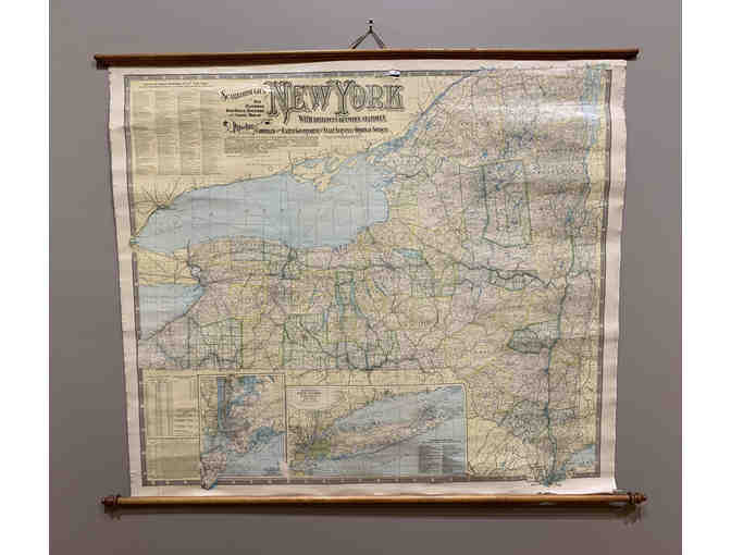
Historic New York State Railroad Wall Map 1903
Item Number: 234
Time Left: CLOSED
Description
"Scarborough's New Railroad, Post Office, Township and County Map of New York With Distances Between Stations. Compiled From The Latest Government and a State Surveys and Original Sources." 1903
The following charts and tables are on the map: List of All Steam Railroads in New York State Counties and County Seats Population of State (1790-1900, every 10 years) Travel Distance a Between Principal Cities of New York State Steamship Lines From New York, Jersey City and Hoboken.
42 x 48 map, good condition, map rolls up nicely using the two wooden poles on which it is adhered.
Special Instructions
Must pick up at the Adirondack History Museum or added shipping charges