Map of Your Vermont Land
Item Number: 132
Time Left: CLOSED
Description
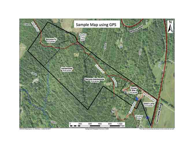
Single-day mapping project for a landowner anywhere in Vermont up to 200 acres. Includes visit to the site, collecting GPS data while walking the land with the landowner(s), and then making for them a custom map that would show their boundary, woods roads and trails, and any interior landmarks selected by the landowner. Finished map provided as a PDF file composed of several layers (e.g., boundary, trails, features) that the landowner could display in various ways and print as they might wish.
Mapping will be done by John Whitman, a Coverts Cooperator from Readsboro, Vermont. He has done many mapping projects and loves walking the land.
Special Instructions
Gift certificates will be mailed to buyer unless they want to pick it up.